Client:
Mandalay Business Capital City Development Ltd
Project Type:
Outline Master Plan, CBD
Site Area:
1,000+ km2
Completion:
2020
Amarapura, Mandalay
In the northern-central region of Myanmar is the city of Mandalay, where Amarapura is one of its suburbs. The second-largest city in the country, it is located strategically next to the Irrawaddy River — the key commercial waterway of Myanmar that cuts through the country.
The Amarapura Urban Development
The Amarapura Urban Development sits on 10 square kilometres of land reclaimed along the Irrawaddy River as part of Mandalay’s flood prevention measures. During periods of heavy rain, the villages in Amarapura are prone to flooding due to their proximal location to the Irrawaddy River. In order to resolve the flooding issues in the villages in Amarapura, the city government asked the client to help with the reclamation of the river bank and raised it to a level of ten meters above the river water level, hence the creation of an additional 10 square kilometers for urban development along Irrawaddy river in the Amarapura District.
MORROW was initially approached to create a Concept Master Plan in this reclaimed area. The initial project brief from the client is to create a low-density housing district with commercial uses. However, after further studying of the site, it was discovered that its geographical position made it a prime spot to develop a central business district (CBD) for Greater Mandalay. With these analysis results shared with the client, the approval for this project was granted but only on one condition – that support from the local government could be obtained for this project.
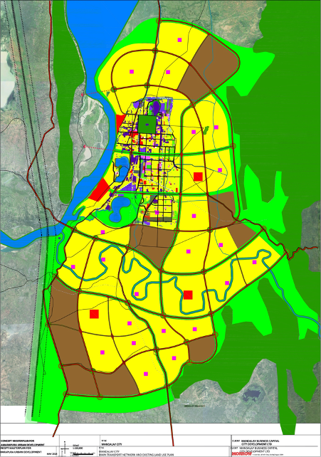
The Planning Approach
As a result, an outline Strategic Master Plan for the Greater Mandalay region of one thousand square kilometres was developed. Considering the city’s prime location between Myanmar’s border with China, and Myanmar’s capital city of Yangon, it was estimated that Mandalay’s population could grow to an upper ceiling of over seven million residents by 2070. To manage such a potentially large population, the future megacity of Mandalay is envisioned to develop as two smaller, and more sustainable sub-cities. The future expanded central city would cater to a population of 4.2 million residents, and the Southern city extension could absorb another 3 million.
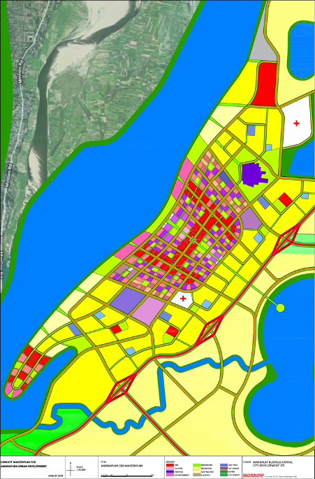
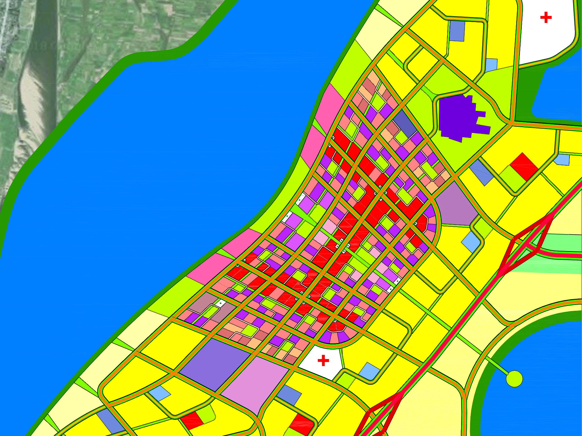
A hierarchy of urban cells, key urban organs, main roads, and rail systems, was also developed, and the plan presented to the city government, including the Mandalay Chief Minister and relevant government officials. With the in-principle approval received, a good functional relation and transportation connectivity to the site with the rest of Mandalay had to be ensured. Given the positive response, a detailed plan was then prepared, of the proposed CBD, and its immediate surrounding residential neighbourhoods and entertainment district within the ten square kilometre site.
Achieving the Main Objectives
With the planning approach taken, there were three main objectives that were achieved. First, the value of the reclaimed site was increased, as the land previously positioned as a low-density housing district, is now positioned as a future CBD for Greater Mandalay. Second, with a Master Plan for Greater Mandalay now, the region can develop into a sustainable and liveable megacity with a CBD by the Irrawaddy River. Lastly, with the plan well integrated with the surrounding mountain ranges and Irrawaddy River to introduce major green belts, residents in the area are able to access the region’s natural environment and the future Greater Mandalay will enhance the natural ecosystem.